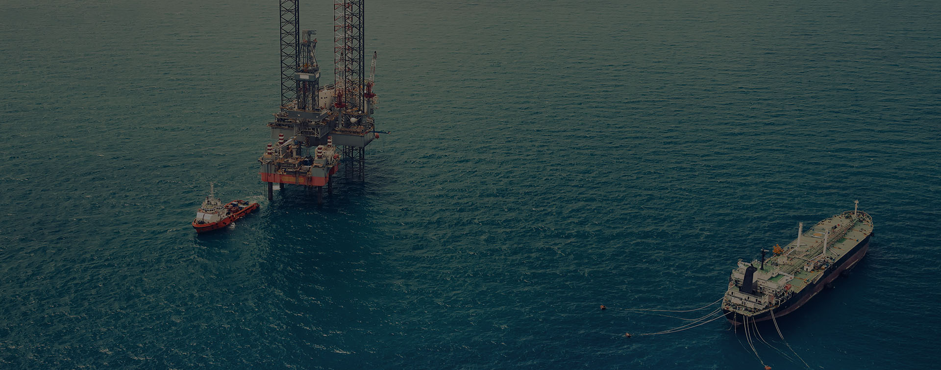
When Hurricane Katrina roared through the Gulf of Mexico in 2005, it took more than 1,200 lives and did billions of dollars in property damage. Winds of 175 miles per hour and waves higher than a seven-story building battered the coastline as well as offshore oil platforms. Repairs to one of these platforms cost millions of dollars and were completed within 18 months of the storm. However, there was no completely up-to-date 3D CAD model of the platform that incorporated the repairs and upgrades over the course of its history.


Location
Galliano, Louisiana

When a New Orleans engineering company was tasked in 2015 with handling electrical and piping upgrades on the platform as well as new construction projects, the firm needed accurate coordinates for tie-in points in order to produce flawless designs. That meant a complete assessment of the platform’s current condition was in order, including measurements of any shifts in the platform’s piping and modules.
When a New Orleans engineering company was tasked in 2015 with handling electrical and piping upgrades on the platform as well as new construction projects, the firm needed accurate coordinates for tie-in points in order to produce flawless designs.
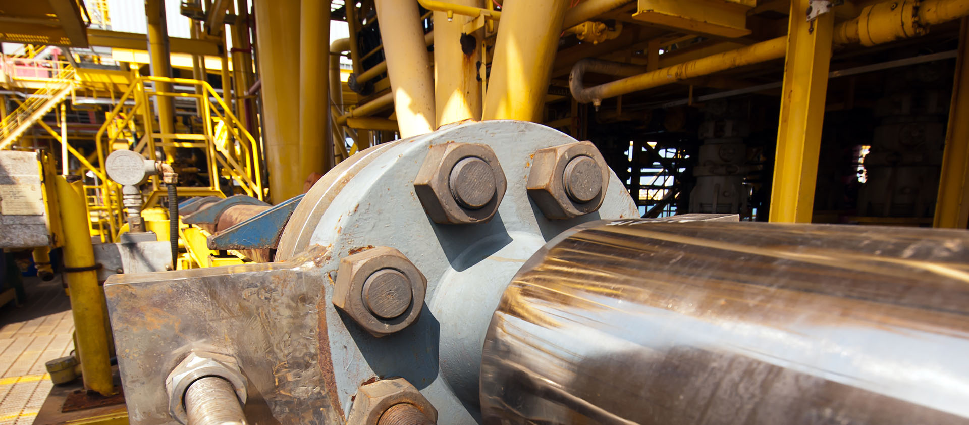
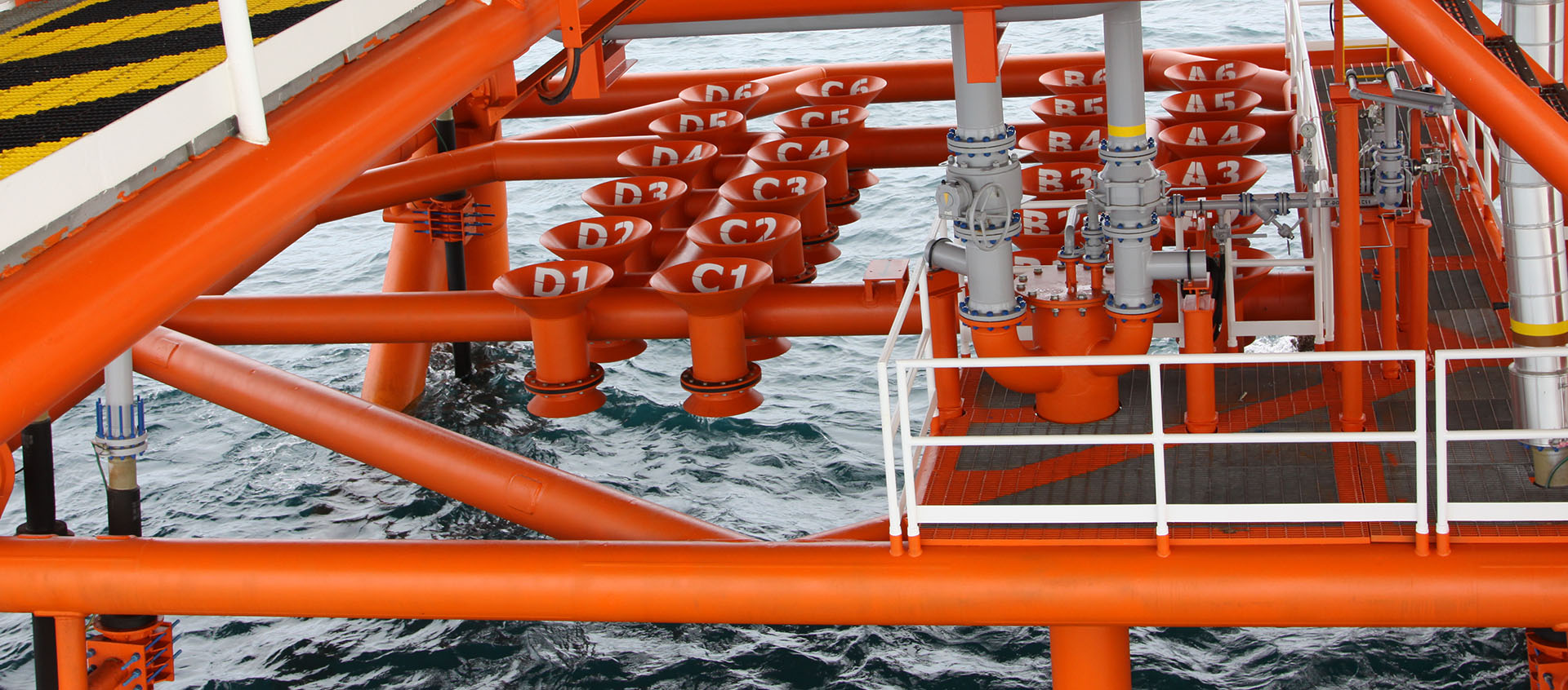
The five-deck platform was the size of a New York City block and every bit as congested, so completing a full assessment of tie-in points was a daunting task. The platform’s location in water that’s almost 3,000 feet deep, tremendous square footage and the complexity of the piping were just part of the problem. Having surveyors clad in safety harnesses climbing around the pipe racks with tape measures was not an option for capturing as-is documentation. Such traditional methods were a recipe for long lead times, inaccuracies, missed measurements and safety issues.
The project manager realized it was time to ask for the assistance of a trusted partner, GIS, located in Louisiana on the Gulf Coast.
Safety, Accuracy and Comprehensive Documentation
Highly skilled workers who were willing and able to work in remote environments, sometimes under harsh weather conditions, were few and far between.
GIS was founded in 1948 to provide repair services to commercial shipping vessels. The company had transitioned to meet the needs of the oil and gas industry when it entered the Gulf region in the 1950s. With decades of industry experience, they were equipped for the challenges of this project.
About five years earlier, Mark Pregeant, CEO of GIS, had become interested in 3D laser scanning technology. He thought it could help him to overcome his difficulties hiring offshore fitters. Highly skilled workers who were willing and able to work in remote environments, sometimes under harsh weather conditions, were few and far between. A laser scanner systematically captures everything visible in its range quickly and accurately and creates a point cloud—a set of data points within a coordinate system. Consequently, it is ideal for capturing as-is conditions in complex spaces. In addition, with a laser scanner, fitters can document tie-ins in elevated areas from the ground, avoiding the need to climb into the piping or erect scaffolding. So, in addition to reducing the number of workers needed, laser scanning could reduce safety risks, and improve the accuracy and comprehensiveness of the data the company collected.
Damian Craig, who is now senior project manager, drafting and laser scanning manager at GIS, admits he was skeptical at first. He could not believe that any technology could supersede his fitting skills. After all, he honed them over many years of working offshore for months at a time. “I had concerns,” he says. “I did not think any technology could replace what I could do with a tape measure. I had a 99 percent accuracy rate, which was necessary because we pre-fabricate pipes and send them to our field workers. We need them to bolt the pipes in place without any sizing issues.”
Despite his misgivings, Craig moved forward with the purchase of a Leica Geosystems laser scanner for the offshore oil platform project. “The accuracy far exceeded that of other scanners,” he says. “Also, it was designed to be a workhorse. We need that when we’re working in an offshore environment.” He explains that all of their equipment takes a beating from salty waters, the movements of boats and helicopters, climbing ladders with it, and more.
The accuracy far exceeded that of other scanners,’ he says. ‘Also, it was designed to be a workhorse.
Fast Answers from a Point Cloud
GIS sent a team of three surveyors to the platform. The first week, they set up primary survey controls and marked where they would place the scanner for each of the scans. The highly congested environment meant that Craig’s crew could only move the laser scanner about two feet at a time instead of the usual 10 to 12 feet. Since they had planned every step they would take in advance, the team was able to scan twenty-four hours a day, cutting the time spent on the project. “You just have to set the scanner up, level it, hit scan and standing by for a little over three minutes while it does the work,” says Craig. With this process, it took four weeks to survey and scan the entire platform.
Since they had planned every step they would take in advance, the team was able to scan twenty-four hours a day…
The team imported the scans into Leica Cyclone software at 25 percent resolution at night while they were in the field. This software enables them to register and stitch together the point cloud data into a cohesive data set. By importing and registering at night, they were able to shorten the turnaround time on the project even further and also to identify any problems with the scans. They might, for instance, identify that scan number 143 was bad. Perhaps there were not enough targets for accurate registration or someone walked in front of the scanner. The technicians could simply re-scan the location the next day and be assured of comprehensive data. If, however, they had waited until the job was complete to identify any poor scans, they likely would not be able to capture the required information due to difficulties accessing the platform.
By importing and registering at night, they were able to shorten the turnaround time on the project even further and also to identify any problems with the scans.
Back in the office, engineers reimported the scans at 100 percent resolution. Since the data was complete and already registered, GIS was able to hand the point cloud over to the project engineers within 10 days. Craig notes that it took longer than usual for post-processing because instead of having one file, as is typical for a project, they had multiple files for each deck elevation. Each of these files contained between 250 and 300 scans. GIS experts trained project engineers on how to use Cyclone and navigate within the point cloud.
With the quick turnaround of accurate, comprehensive data, the engineers were able to make progress on the platform’s projects without interruption. That’s because there’s no need for them to send workers out to take measurements. They simply refer to the point cloud.
‘Astronomical’ Savings
Craig has a difficult time estimating the amount of money saved by using laser scanning. Of course, it saved time in the measurement process, but he sees even more value in how much was saved by preventing errors. If, for example, a section of pipe does not fit, you have to take it down, put it back on a boat, take it to the yard for repairs and then transport it back to the oil platform. That’s an expensive exercise.
In my opinion it’s an astronomical amount of money saved…in the millions of dollars, he says.
HIGH-VALUE DELIVERABLES
- High resolution registered point clouds
BENEFITS
Increased Safety
All data captured from ground level
Fast Data Collection
All data captured in four weeks, reducing project turnaround time
Comprehensive Data Capture
Complete and accurate as-is dataset minimized plant downtime and rework
Better Project Visualization
Seamless point clouds ensured that designs did not clash with existing construction and all new components fit perfectly, saving millions of dollars in rework