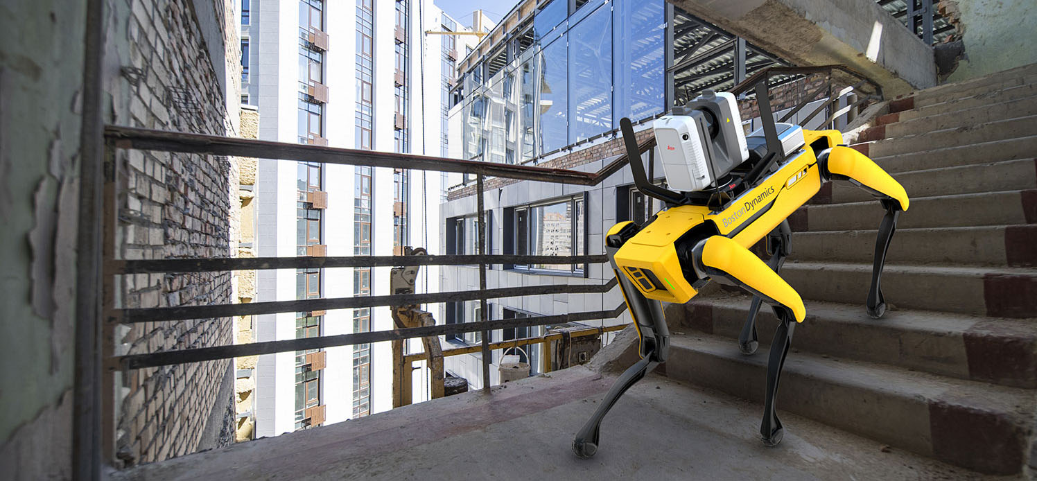
A new integration of Leica Geosystems’ RTC360 technology onto Boston Dynamics agile mobile robot Spot makes it possible for any plant to take advantage of the benefits of digital remote management.
Laser scanning is widely recognized as the fastest, safest and most effective way to capture comprehensive as-built data on the plant environment for retooling, expansions and improved day-to-day operations and maintenance through digital remote management. But it isn’t always possible to allow human operators into the areas of the plant that need to be scanned. Some companies have already begun using agile mobile robots for this purpose. Now a new integration of Leica Geosystems’ RTC360 technology onto Boston Dynamics agile mobile robot Spot makes it possible for any plant to take advantage of the benefits. (You can read the full news release here.)


The combination of Spot’s ability to cover many types of terrain and the RTC360’s VIS (Visual Inertial System) technology enables repeat automated scanning paths through the plant to be programmed and achieved with minimal involvement from a human operator. While mounted atop Spot, the Leica RTC360’s VIS technology uses five cameras to track the scanner’s movement within the site between the scans. The VIS system provides an unmatched level of accurate and automated in-field pre-registration to streamline the reality capture process. While scanning, the user only needs to trigger each scan remotely via mobile device while Spot and the RTC360 navigate the programmed scanning path.
RELATED: See how digital remote manufacturing lets you access your plant anytime and from anywhere.
Scanning is achieved rapidly since Spot does the walking and stationing of individual scans.
The RTC360’s VIS (Visual Inertial System) technology creates a fast, easy scanning workflow. For example, users can essentially “walk” Spot through a site by using a mobile device to control the RTC360 scanner. This allows users to speed up routine as-built documentation tasks and capture data accurately, quickly, and frequently. It also automatically combines captured scan data from station to station as it knows its location in space, resulting in a completely pre-registered point cloud of the entire scanned site, which makes final data processing in the office much easier.
Scanning is achieved rapidly since Spot does the walking and stationing of individual scans. Once Spot and the RTC360 learn a programmed scanning route through a location, they can more easily and quickly repeat that route for regular scanning. The remote control of the Leica RTC360 via a mobile device allows Spot’s agility and mobility to cover terrain that may be difficult or hazardous for a human operator.
The new Leica RTC360 for Spot includes all needed installation accessories, a protection bar for the scanner cameras, and Leica Geosystems software ensuring that users can get started within minutes. The RTC360 installation kit for Spot is available through Leica Geosystems distribution channels and Spot through Boston Dynamics.