Digital Remote
Management
Access and Manage Your Plant Remotely. Anytime, Anywhere.
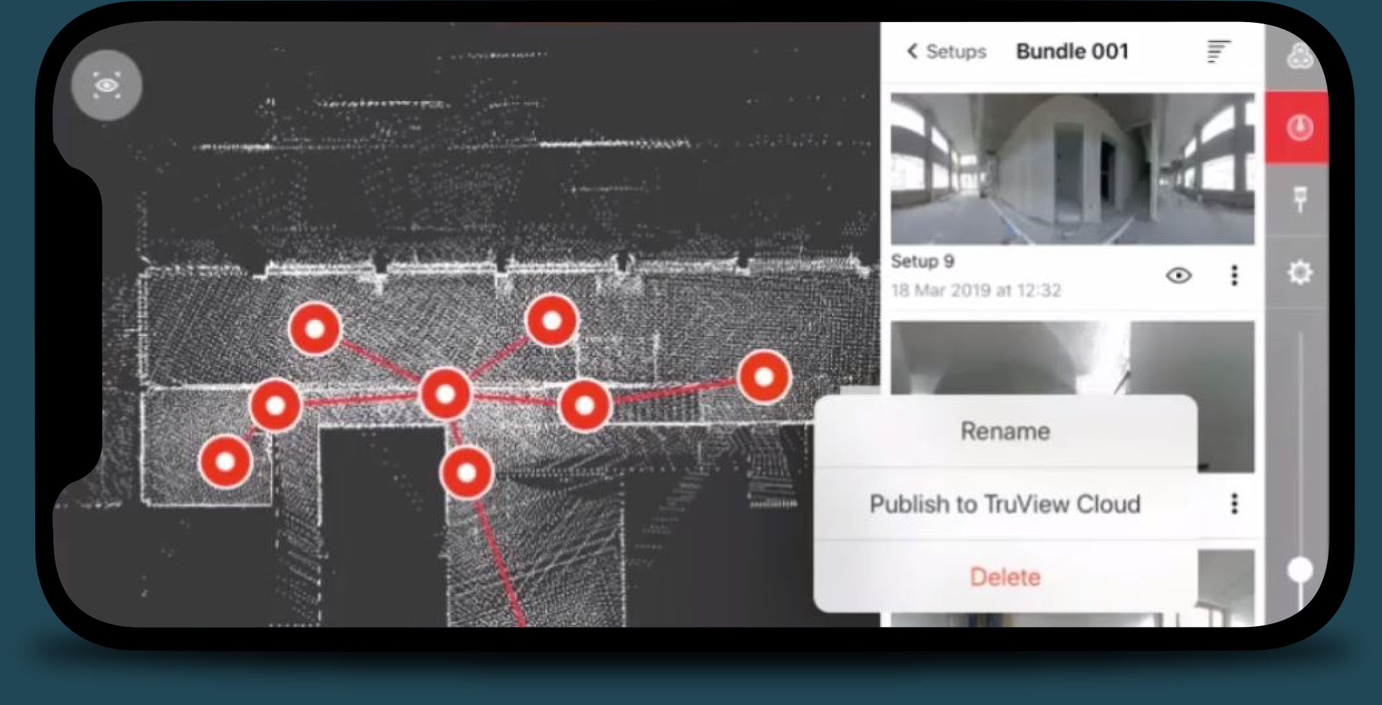
360º Plant
access
View accurate as-is data and imagery on every area of your plant. Leica TruView is a cloud-based tool for remote work that allows you to view and share a complete digital twin of your facility. Move from scan location to scan location and view each scan setup in 360 degrees, including detailed point clouds, imagery and plant records, by virtually accessing the data in a browser. Upload your point cloud data to TruView and share it with anyone in the world through secure and private data sharing. It’s a simple way to provide remote access to your plant for project planning, training or preventive maintenance with no software installation required.
Cloud-Based
Collaboration
TruView is the easiest way to share point cloud data captured with laser scanning. When you use TruView to upload your laser scanned projects to the cloud, anyone from plant engineers and managers to project stakeholders and team members can view and access your project data in a browser via a shared link for live collaboration. TruView offers:
- Virtual, photo-realistic visits to plant sites from anywhere, anytime.
- Users can view, pan, zoom, measure and markup.
- No plug-in required, accessible from any browser on any device.
- Public or private sharing with complete control over access.
Real-time
data sharing
TruView is the easiest way to share point cloud data captured with laser scanning. When you use TruView to upload your laser scanned projects to the cloud, anyone from plant engineers and managers to project stakeholders and team members can view and access your project data in a browser via a shared link for live collaboration. TruView offers:
Experience the power of Digital remote management
Virtual plant walkthroughs
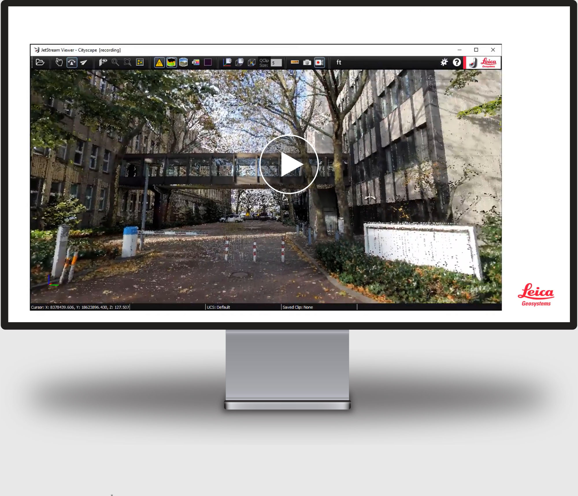
- Move freely through point clouds in 3D for a virtual validation walkdown.
- Take screen recordings of point cloud flythroughs.
- Create visual presentations directly from point cloud data.
- Use .LGS files to quickly deliver smooth visualizations of specific areas of the plant.