This unique combination of photogrammetry and lidar data allows you to get a much more complete digital twin of the spaces, structures and systems that you document or scan on a day-to-day basis.
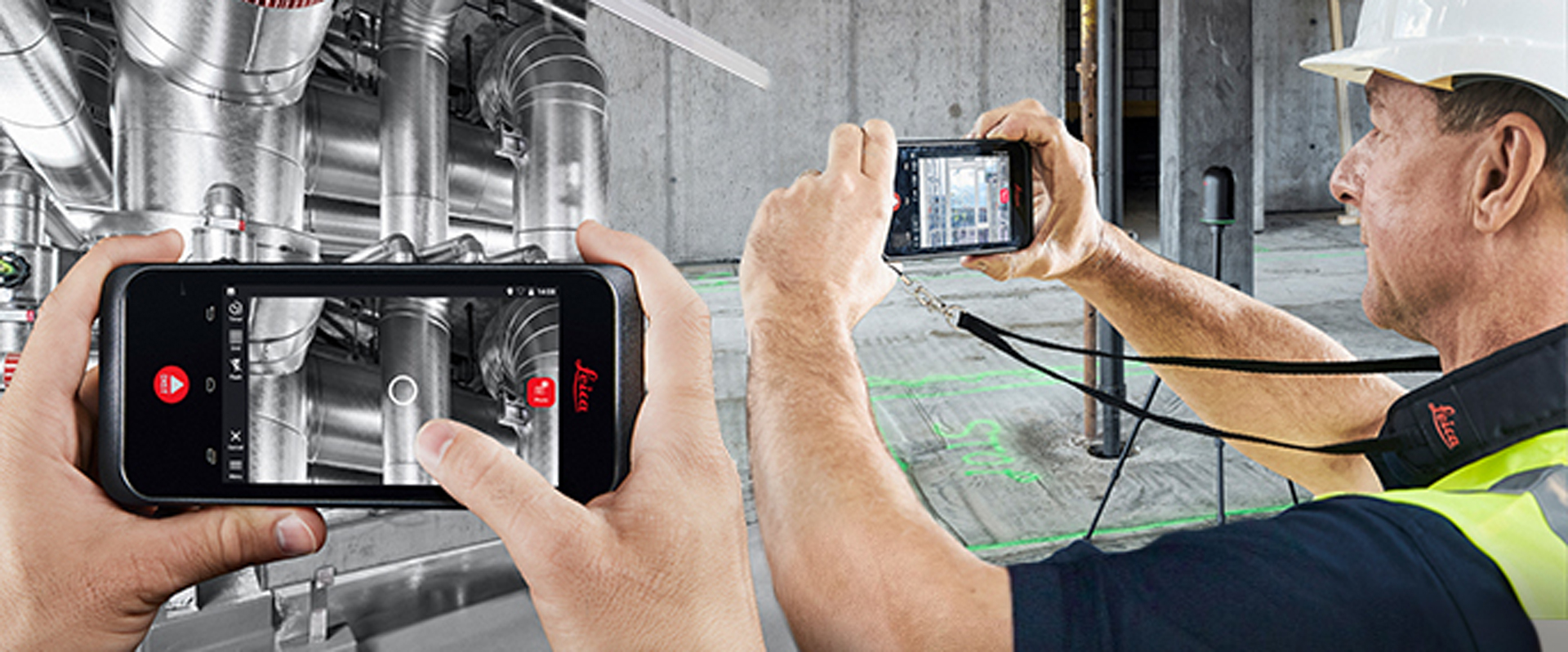
Laser scanning is unequivocally the best way to quickly capture millions of accurate measurement points for as-built documentation on industrial plants. But even if you’re using the latest high-speed, state-of-the-art BLK360 and RTC360 scanners, there’s still room to improve efficiency, minimize scan setups and capture measurable data in inaccessible areas.

Company
Any Company

Location
Anywhere

Enter the BLK3D. A simple handheld device, the BLK3D has the power to provide independent photogrammetry and laser measurement capabilities while also serving as a scanning controller.
A new on-demand webinar explores the end-to-end solution. Subject matter experts show how to control your laser scanner with Cyclone FIELD 360 onboard the BLK3D, capture 3D measurable images and geotags with the BLK3D, process the data in Cyclone REGISTER 360, and enable downstream access in Jetstream and TruView for the ultimate high-speed, high-accessibility laser scanning workflow.
You’ll learn:
- Why 3D measurable images are better than standard 2D images from smartphones or tablets
- How to improve communication with stakeholders by including measurable, annotated images with your point clouds
- Why you need to rethink the way you control your laser scanner