A new on-demand webinar explores the end-to-end solution that will change the way you see laser scanning.
“There is never any question that every project begins with scanning; the value that it adds to projects is evident.”
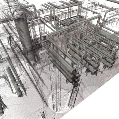
Without a plant coordinate system to hold and align your scanning work, you risk inaccuracies, inconsistencies, and disconnected data sets that can prevent you from achieving a true digital twin.
An article from the Manufacturing Leadership Council details how a digital twin empowers manufacturers to be fast, agile and resilient.
The ability to quickly and easily capture and manage an accurate digital record of all plant assets creates new ways to optimize plant performance.
Which laser scanner is better? The answer might surprise you.
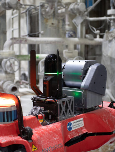
A new integration of Leica Geosystems’ RTC360 technology onto Boston Dynamics agile mobile robot Spot opens new possibilities for digital remote management.
Autonomous laser scanning technology integrated with robust and mobile robotic inspection systems provide new insight that provides a big impact on plant operations.
Is establishing an accurate plant coordinate system really as simple as it sounds? Here’s an overview of what’s involved and how you can benefit.
No More Content